|
This site presents a
comparison of flood maps produced in the City commissioned report
titled “Hydrogeological Characterization and Groundwater Flow Modelling
Report” by Klohn Crippen Berger(KCB) dated Jan 4, 2021, and flood
maps produced by the City in their Bowness flood barrier: Feasibility
Study - Community Information Booklet, both copyright the City
of Calgary 2021.
According to the City's groundwater video, basement floors are not impermeable and will flood once the water table rises above the basement floor elevation, if there is no other mitigation. The KCB Report may be read in full by visiting the City of Calgary website here: https://www.calgary.ca/uep/water/construction-projects/construction-projects-and-upgrades/community-flood-barrier-related-studies-and-reports.html Instructions: |
This flood information is from the City commissioned Klohn Crippen Berger report (Jan 2021).
|
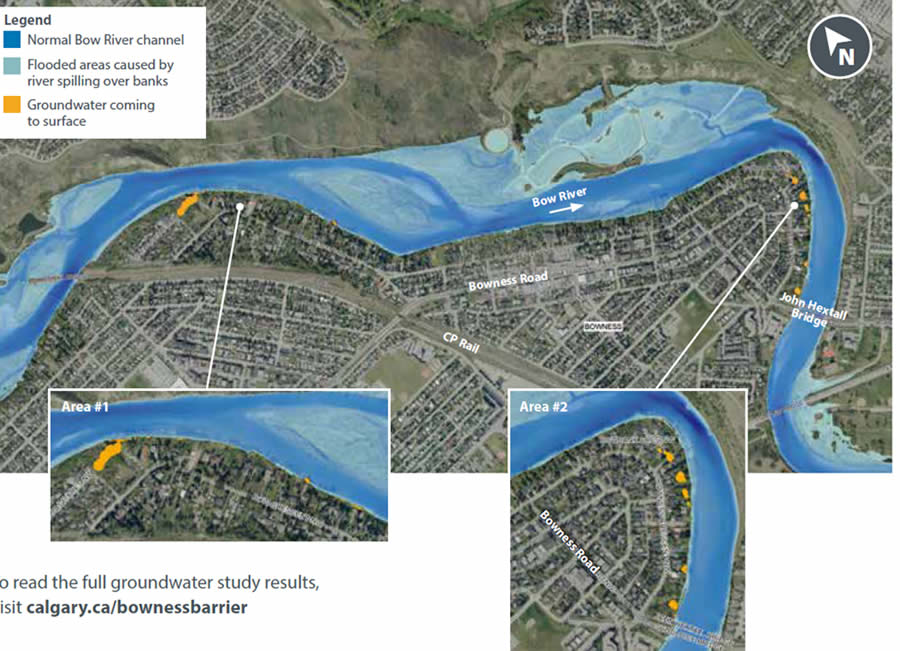
The
map below is from page 9 of the City’s community information booklet.
As you can see, these maps are very different indicators of groundwater. The first shows red (which is groundwater to surface) for most of Bowness east on Bow Crescent. The city booklet map above only shows a few (5-6) pockets. As well the city booklet does not show anywhere on the map, the light blue, yellow, or orange colours, which represents water levels above the typical basement floor. In the City’s information sessions on Jan 13 and Jan 19 2021, the question was asked as to what the City map in the booklet represented. KCB answered that it represented a moment in time earlier in the flood. Also asked was why the City did not publish a map showing the water levels relative to people’s basements. The City responded with the “focus” of the barrier is overland flooding. For more information go to bownessrfm.ca
|
* BRFM takes no responsibility for, and will not accept any liability in respect
of the accuracy or
completeness of the information
contained in these
materials, for any errors, omissions or misstatement
in
or from these materials. Or for any loss howsoever
arising from the use of these materials. Disclaimer